
Cyclone Kiyapo has now intensified into a tropical storm, according to the state weather bureau PAGASA.
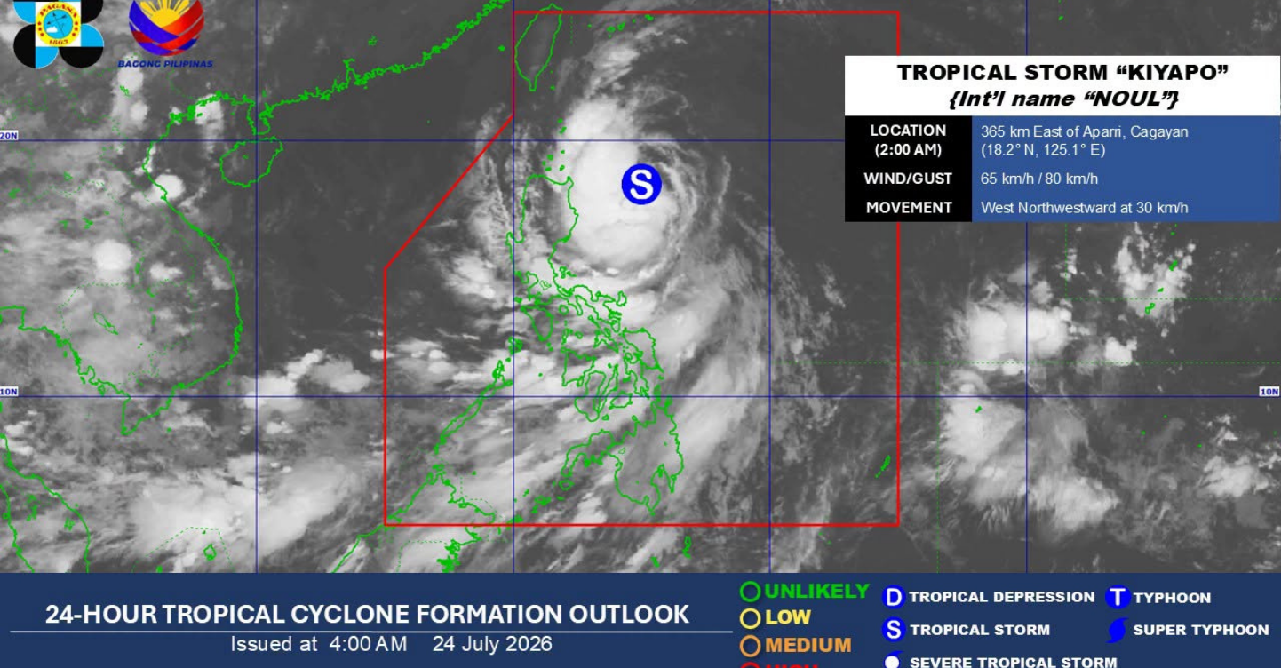
Photo: PAGASA/Facebook
Here are some important reminders to keep in mind:
According to a 2:00 AM advisory on Friday, June 24, Tropical Cyclone Kiyapo Bavi (international name: Noul) is now being monitored inside the Philippine Area of Responsibility (PAR).
The super typhoon was estimated to be 365 kilometers (km) east of Aparri Cagayan, moving northwestward at 30 kilometers per hour (kmh), with maximum sustained winds of 65 km/h and gusts up to 80 kmh.
Another separate weather advisory issued at 5:00 AM stated that heavy rainfall may take place in Batanes, Cagayan, Apayao, Ilocos Norte, Isabela, Abra, Ilocos Sur, Kalinga, Benguet, and La Union.
Moreover, forecasted rainfall may be higher in mountainous and elevated areas.
The public is advised to take all necessary measures to protect life and property. At the same time, everyone is encouraged to continue monitoring official weather updates as forecasts may change.
To stay updated with the latest advisories, head to PAGASA’s official Facebook page.
ALSO READ: Super Typhoon Bavi May Enter PAR—Here’s What You Need to Know