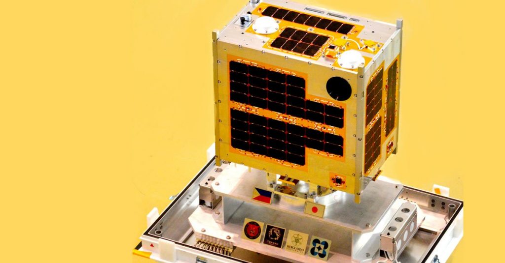
DIWATA-1, the Philippines’ first micro-satellite that was launched April already sent high-resolution images from space.
According to a post from the Hokkaido University, the images captured from the High Precision Telescope on DIWATA-1 have a ground resolution of about 3 meters. This means that they are “a world-best for a 50 kg-class microsatellite.”
DIWATA-1 was built with an PhP 800 million budget and the program ran for three years. It is the first microsatellite designed, developed, and assembled by Filipino researchers and engineers backed by the Department of Science and Technology (DOST), and the University of the Philippines Diliman (UPD) with the guidance of Japanese experts from Hokkaido University and Tohoku University.
The following photo is from Hokkaido University.
According to Hokkaido University:
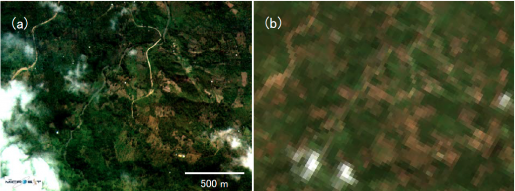
This graphic compares two RGB images of Dumingag on the island of Mindanao, Philippines. Image (a) was taken by the HPT installed in DIWATA-1, while image (b) was taken by Landsat 8’s OLI. These results demonstrate that DIWATA-1 can observe the Earth at significantly higher resolutions than existing large satellites.
Here’s another image comparison.
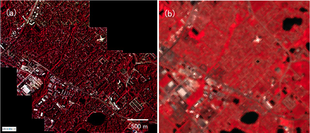
This graphic compares two false-color images of a suburban area in Florida, United States. Image (a) was taken by the HPT installed in DIWATA-1, while image (b) was taken by Landsat 8’s OLI. To emphasize areas of vegetation, near-infrared-band data was used to create the image.
With this development, they aim to “improve the accuracy of spectral information used for agriculture, the fisheries industry, forest management, resource development, and disaster monitoring, etc.”
Anything to add to this story? Share your thoughts with us.


