Be careful, everyone!
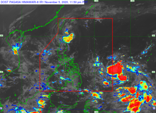
After Typhoon Rolly (Goni) ravaged parts of the Philippines and left, then came Severe Tropical Storm Siony (Atsani). Currently, Siony is on its way out of the Philippine Area of Responsibility (PAR), but we can’t rest easy just yet. In fact, a new Low-Pressure Area (LPA) entered the radar just this afternoon, on November 6.

Photo from PAGASA
According to the Philippine Atmospheric, Geophysical, and Astronomical Services Administration (PAGASA), as of 5 PM this Friday, Siony was 145 kilometers west-northwest of Itbayat, Batanes—specifically over the Bashi Channel. Currently, it’s moving at 20 kilometers per hour, and if it maintains that speed, it would exit PAR in the evening.
However, parts of the country—specifically Eastern Visayas, Central Visayas, Mindanao, and Bicol—may experience scattered rain showers in the next 24 hours.
Should the LPA develop into a tropical depression in the next 36 hours, it will be given the local name Tonyo.
[Also Read: SM Supermalls to Accommodate People Seeking Shelter from the Typhoon]
What do you think of this?
Do you have a story for the WhenInManila.com Team? Email me at diane.wheninmanila@gmail.com or send a direct message to our WhenInManila.com Facebook Page. Interact with the team and join the WhenInManila.com Community at WIM Squad! Don’t forget to join us on Viber for updates while you’re at it!


