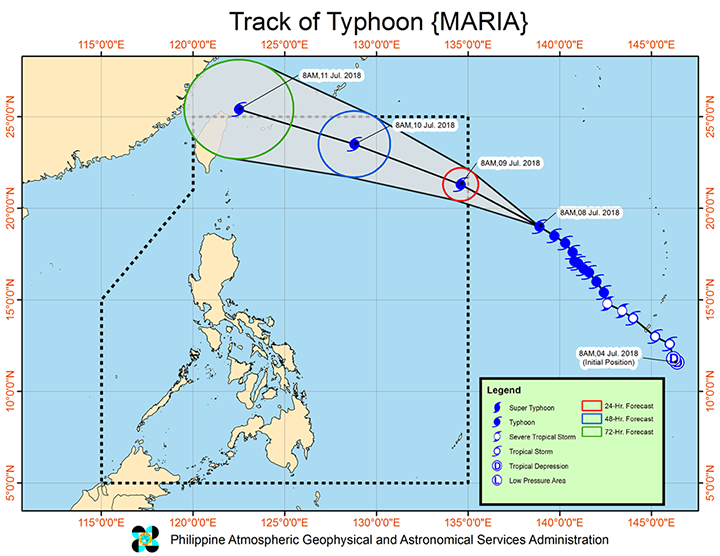
Typhoon Maria, locally known as Gardo, was seen to be slightly stronger and faster as it prepares to enter the Philippine Area of Responsibility (PAR) on July 9, 2018 (Monday).
According to the Philippine Atmospheric, Geophysical and Astronomical Services Administration (PAGASA) in a bulletin dated today at 4PM, Gardo has maximum winds of 190 kilometers per hour (km/h) from the previous 185 km/h, and gustiness of up to 235 km/h from the previous 225 km/h.
It is expected to enter the Philippines in the morning.
Gardo is not expected to make landfall but it will enhance the southwest monsoon, which is affecting Luzon and Visayas. It will bring light to heavy rain in Metro Manila, Mimaropa, Calabarzon, Western Visayas, Cagayan, Isabela, Quirino, Aurora, Bataan, and Zambales. The rest of the Philippines will experience isolated rainshowers or thunderstorms.
The typhoon will leave PAR on July 11 (Wednesday) in the morning.
Classes have already been suspended in all levels in the following locations:
- Marikina City
- Muntinlupa City
- Parañaque City
- Cavite (Bacoor and Dasmariñas)
- Rizal (Binangonan, Cainta, Morong, Rodriguez, Tanay, and Taytay)
Stay safe, everyone!


